

This past Sunday marked the end of a journey that we began last summer on May 25th, the journey from Mexico to Canada along the Continental Divide Trail. Only this journey, unlike our other two thru-hikes of the AT and PCT, was much less linear and a little more complicated.
Last summer when we hiked the CDT, I quit the trail at Copper Mountain, Colorado. I was done. I said my goodbyes to Matt and watched him walk up the trail alone. I spent a week being miserable and feeling guilty for having abandoned my best friend on the most difficult trail out there, and later when he went through Steamboat Springs, CO, I got back on and finished the remaining miles with him. When we went to cover the section I missed, flooding in Colorado forced us off the trail and I left 175 unfinished miles on the table. It was heart-breaking yet the epitome of the CDT journey – that nothing is easy or certain. Fast forward to this year, where I had vacation time from work, the desire to finish those miles, and a 100 mile race in Steamboat Springs to represent the perfect reasoning for coming back to Colorado to officially complete the CDT miles and therefore the Triple Crown of US long distance trails. Here’s a recap of our last week on the CDT.
THE CDT STRIKES BACK
Oh, you sneaky little CDT. As I said, nothing is ever easy with this trail and from the moment we got to the Denver airport on Saturday, August 30th, we had to problem-solve, big-time. The one thing I was worried about, our private shuttle showing up at the airport to take us to the trail, was right on time and awaiting our arrival. Check! We asked the driver to wait just 15 minutes more for our checked luggage, our hiking poles and tent stakes. An hour later and no hiking poles or tent stakes to show for our waiting time, we were filling out a missing luggage report and the wind was knocked out of our sails. We needed both our hiking poles and tent stakes to set up our tent, which was absolutely useless without them. A quick internet search showed a gear shop right off I-70, on the way to the trailhead, and thankfully our ride agreed to stop there so we could rent poles and buy tent stakes. Three hours after arriving in Denver, we finally made it to the Herman Gulch Trailhead, already at 10,302 feet. Yikes! I hoped our sea-level lungs could adjust quickly, because we were only going up from there. That first night we got 2.5 miles out before a thunderstorm blew in and stayed for the evening, bringing in hail, fog, rain, and general fear for what else the CDT had to offer for the next week of miles.
CAN WE REALLY DO THIS?
Our first full day, Sunday, started out fairly dry. The storms had cleared, though the clouds hadn’t, and our spirits were high as we started out at first daylight. I didn’t get a lick of sleep because I wasn’t used to sleeping outside among the animals again, listening for every little twig snap or every swish of leaves under some little squirrel’s paws. The day ahead of us included two no-named summits at 13,199 and 12,647. Only in Colorado do summits that high not even get the respect of being named. After the first summit we crossed a jeep road and it started snowing so heavily that we felt it wasn’t smart to continue, considering we weren’t carrying heavy wind/snow/rain gear, so we dropped down a 1,000 feet on the jeep road, into the trees. We set up the tent and waited out the snow for 4 hours, all the time looking at each other and asking, “Can we do this?” Our odds of finishing seemed doubtful if that kind of weather continued.
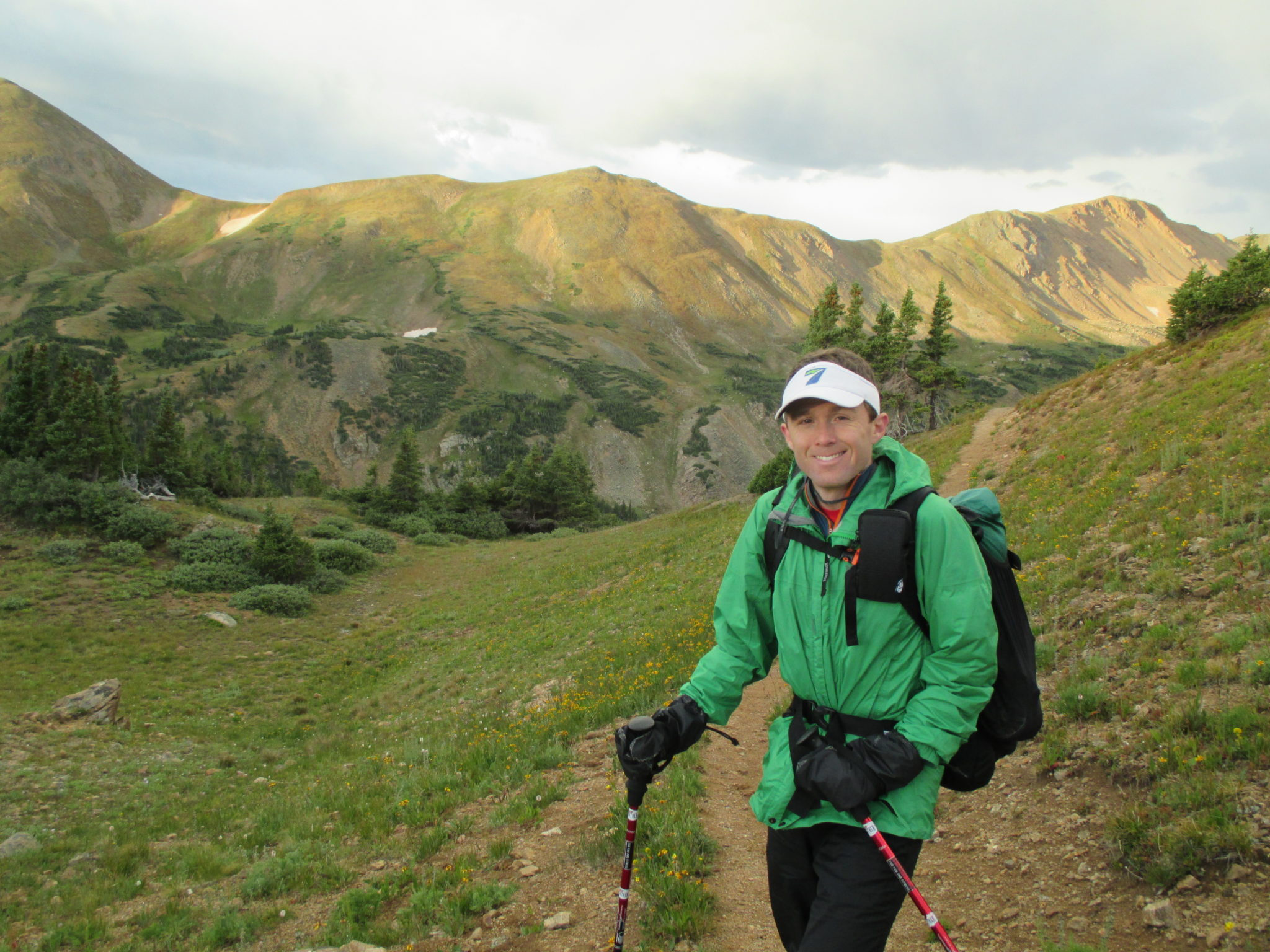
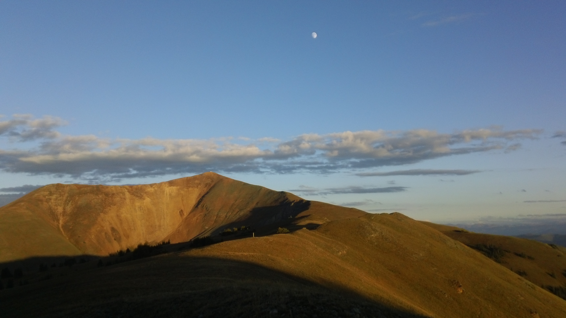
Already above treeline on our first day.
After a short clearing of the skies, we packed up and continued on, only to be stranded just below the second summit because of another snow storm moving in, including lightning. It was nuts. We huddled together in a small cave indented into the side of the trail, ate snacks, and hoped it would pass. Once it felt safe enough to keep walking, we got to tree line with barely 13 miles done for the day at 5:30pm. As we set up the tent, it started thunderstorming and hailing again. By sunset it was clear skies and we were already tired of sitting in our tent, so we excitedly packed up, put on the headlamps, and walked 7 more miles that evening, summiting Stanley Mountain at 12,496, before dropping down and setting up camp just before Berthoud Pass. It was such a cold night that we had frost on both the inside and outside of our tent.
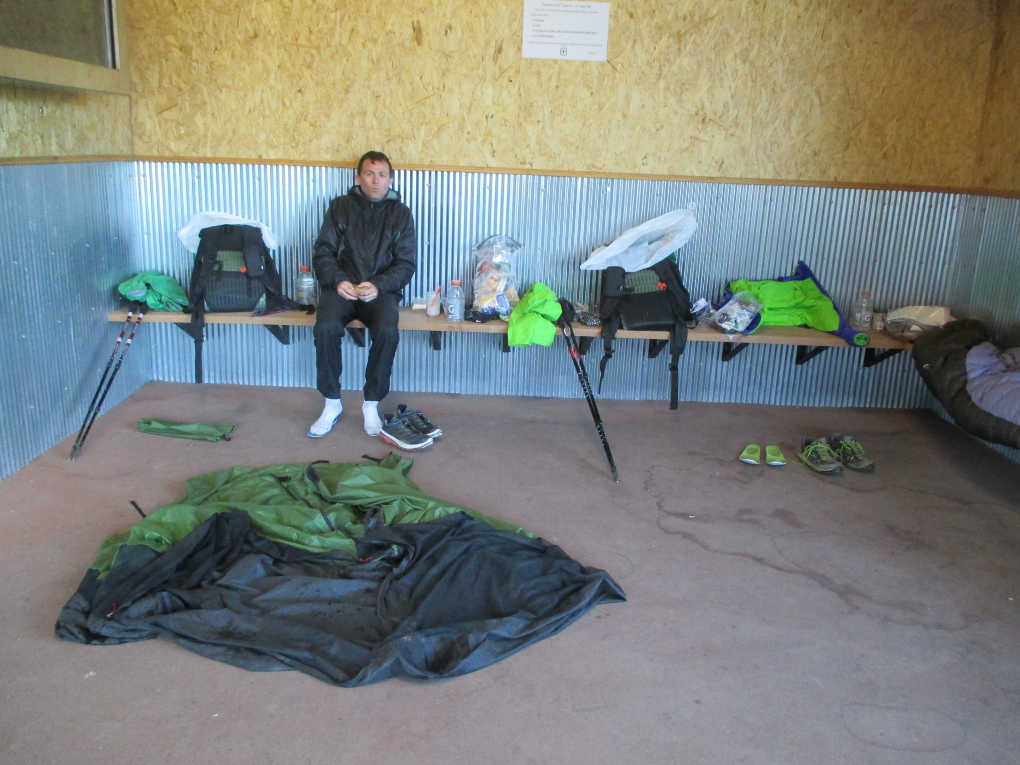
Drying out and warming up at Berthoud Pass.
FROZEN FLORA
After thawing out and drying our gear in the warming hut at Berthoud Pass, we took on our biggest day yet, covering over 25 miles up and over Mount Flora at 13,113, up and over James Peak at 13,308, and then along the never-ending trail-less ridgeline to Rollins Pass, and through one last push to Devils Thumb Pass. It was the sunniest, clearest day on the trail yet, without a threat of thunderstorms, but also the windiest day I’ve ever walked in, and nearly all of it was above tree line. We dipped into the 10,000 feet range for about 5 miles of the entire day.
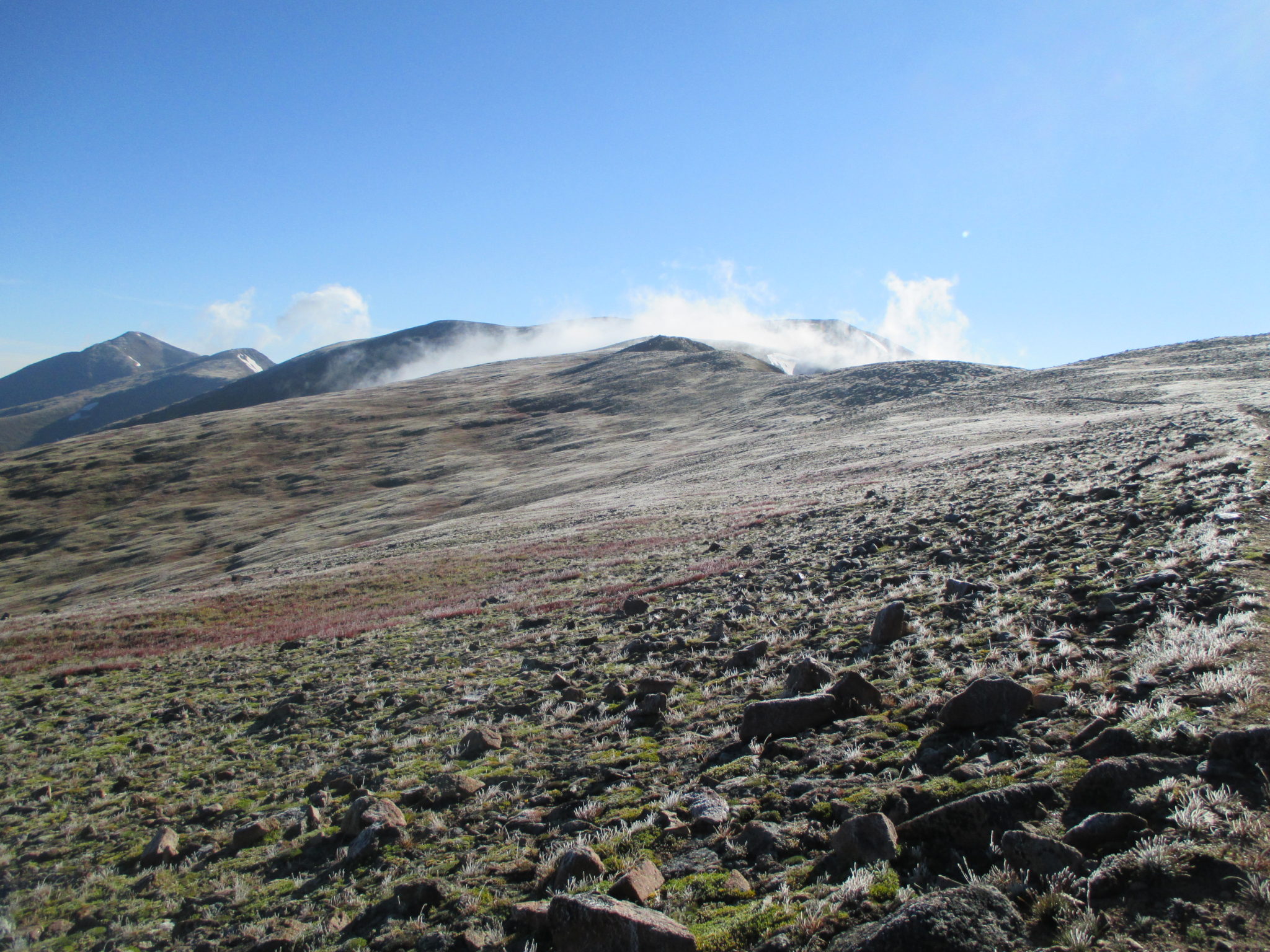
A frozen Mount Flora on a cold, windy, clear morning.
The early morning on Mount Flora revealed a frozen tundra-like summit, and while it had thawed out on James Peak, the wind was unrelenting. We wore all our clothing except our puffy jackets and my nose was raw and bleeding from all the wind on my seeping, snot-filled sinuses. For about 5 miles until Rollins Pass, there was no trail, just cairns to spot in the distance and lots of lichen-covered rocks to maneuver over. We walked with a purpose, nearly numb with the wind screaming in our ears, and when we reached the sign at Rollins Pass, I just leaned against it and enjoyed five minutes without the wind. The day ended with one final push through the wind until Devils Thumb Pass, where we dropped down into the trees once again, our only solace after such a tough day.
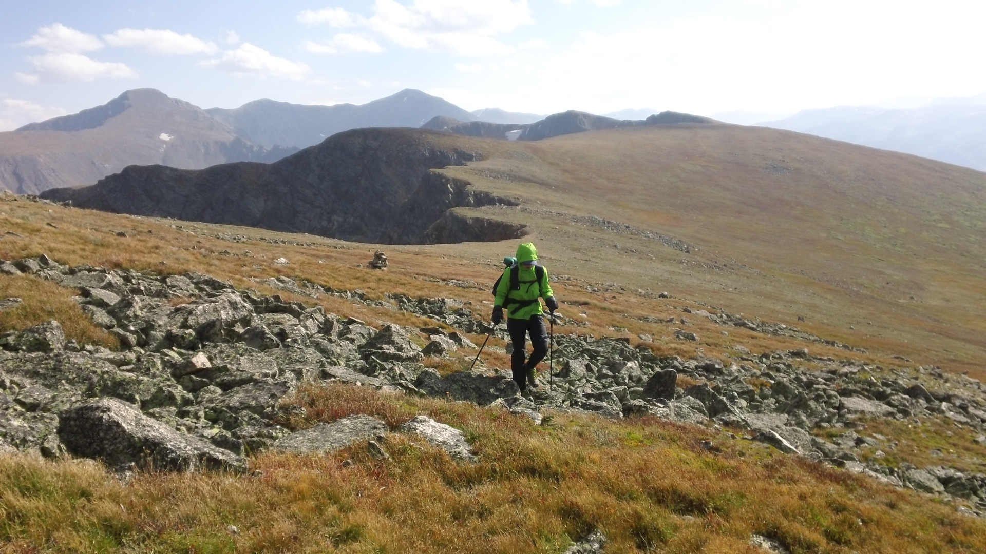
Walking the rolling ridgeline from James Peak to Rollins Pass on a cold, windy day.
REGISTERS ARE A GOOD THING
The next 30 miles were a stroll in the woods compared to the two prior days, with warm sunny skies above us, trees surrounding us to offer protection from the wind, and plenty of water. We wore shorts and t-shirts for the first time on the trip, broke out the mp3 players and sang loudly in the empty woods, and even walked by several popular local trailheads, like Indian Peaks and Monarch Lake, where we signed into the registers once again as Optimist and Stopwatch. When we walked into the town of Grand Lake on Wednesday morning, we had the comfort of knowing that we were staying in town that night and had just 99 miles to go.
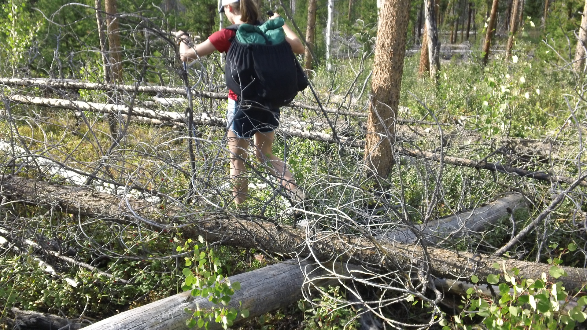
The Knight’s Ridge, a 1.5 mile section of blowdowns and no trail, before the start of Rocky Mountain National Park.
As we were checking out at the grocery store in Grand Lake, Matt received a text from a friend, with a conversation between him and Matt that read, “So I’m at a trailhead this morning, getting ready to run to Columbine Lake and lo and behold see Optimist and Stopwatch registered in the log book yesterday. Ha ha, pretty cool. This is Ryan by the way. Let me know if you guys have time to say hi in Steamboat. I’m free until Saturday. Peace.”
Matt: “That is awesome. We’re in Grand Lake today and hiking out tomorrow. Should be in Steamboat by Sunday.”
Ryan: “Are you in the town of Grand Lake today? You are literally 15 minutes from my house. I could drive up to see you guys if you are free.”
Matt: “Come on over!”
And just like that we had a visitor for the day, our friend Ryan, who lives near Winter Park, CO. We spent a relaxing afternoon with him, hashing over recent and future ultra races, and eating food and drinking iced coffee, our newest late-afternoon treat. It was a great town stop and made all the previous days’ efforts worth it.
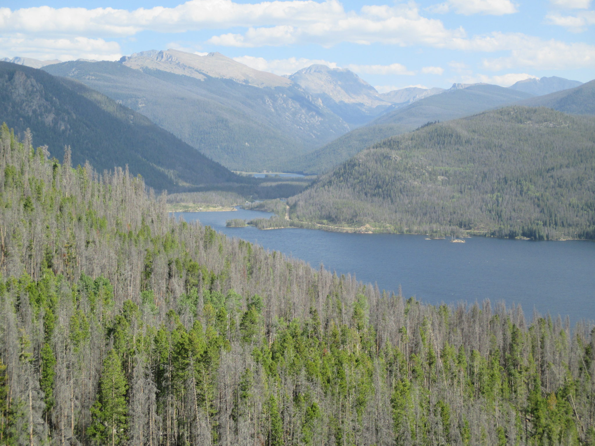
A view looking back at where we came from as we headed into Grand Lake.
ONE FINAL PUSH
Last year as Matt made his way past the Rocky Mountain National Park, he had to skip the RMNP loop, an additional 18 mile loop that climbs up to a flat-top high point of 12,228, before dropping back down near its starting point. There had been a wildfire earlier in the year that caused the park to close that loop for many months. This time around, the loop was open, so it was Matt’s opportunity to finish up those miles as well, and we had our friend Ryan to join us for the loop. We started early and hiked quickly to get in the high miles before the clouds moved in overhead. On the second half of the loop, we saw two huge elk and one large moose hanging out in a meadow, and soon we were saying goodbye to Ryan as he took the 4 mile trail back to Grand Lake to head home. It was a beautiful loop with fairly easy hiking, compared to the rest of the CDT, so I’d definitely recommend it to anyone in the area of RMNP.

The flat top portion of the Rocky Mountain National Park loop.
Shortly after Ryan left the skies clouded up and rain turned from drizzle to downpour. At least we had gotten through the high stuff without rain, but no matter where we hiked, rain always put a damper on things. We trudged into the Never Summer Wilderness, set up a wet tent about halfway up the climb to Bowen Pass, and fell asleep to rain dripping from the trees above.
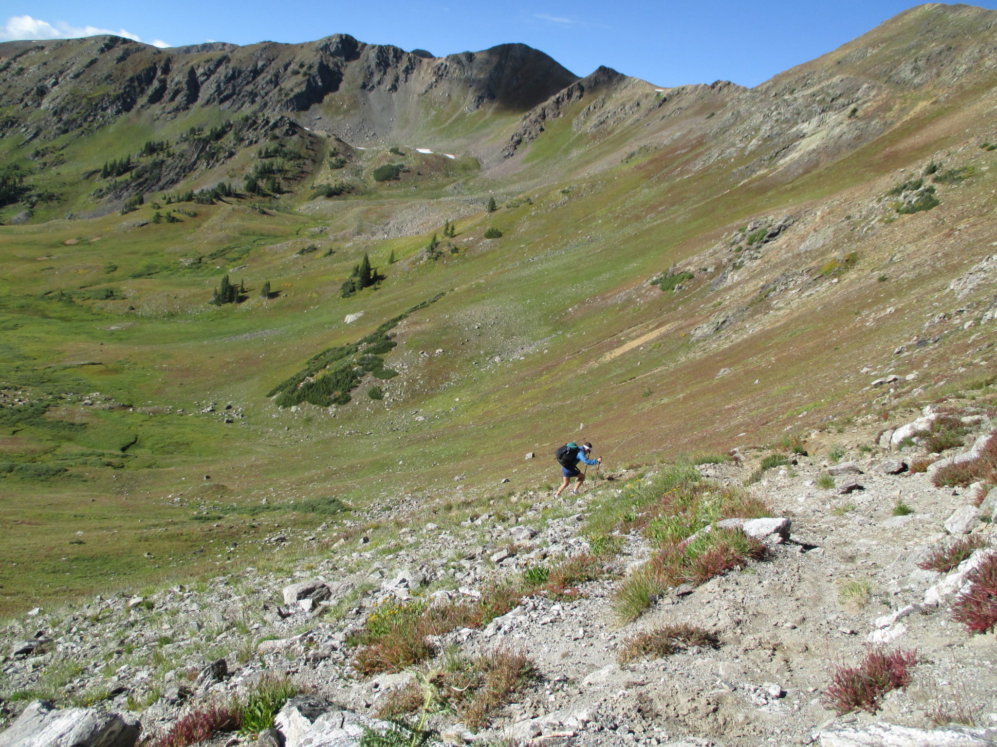
A steep final push up to Bowen Pass in the Never Summer Wilderness.
It was a cold, clear morning that followed and just before Bowen Pass we were able to dry everything out in the warm sun. Thank goodness for that. It was a good start to the day. It was also an uneventful day until the late afternoon when we approached the summit of Parkview Mountain at 12,284 feet. Thunderstorms and a light drizzle had moved in by the time we were approaching tree line. In just .6 miles from a fire road to the ridge before the summit, we climbed 1,000 feet. We were basically scurrying up loose rock, digging our feet into any possible patch of grass, and with just a couple hundred feet to go, it started snowing with strong winds in our face. We found some bushes to tuck into and waited for the worst of the snow to pass. Our only option was to keep moving forward because the thought of descending straight down the mountain we had just climbed was scarier than pushing through snow. As soon as the skies cleared up enough, we made one last push for the summit and ran into the fire lookout at the top, an enclosed building to block the wind. Winds blew fiercely against the hut and by some miracle, the skies cleared within 10 minutes to reveal sunny, clear skies. The rest of the evening was spent descending Parkview Mountain along the rolling ridgeline, and we ended the day tucked into the trees. It had been a hard day but it also meant we had just 44 miles left to Steamboat Springs, which we knew we could easily cover in the next two days.
Looking back at Parkview Mountain as we descending the rolling ridgeline while the sun was setting.
THE END
The summit up to Parkview Mountain was the last of the craziness on the CDT. The next two days into Steamboat were still challenging, with a few moments of steep climbing and another few moments off trail, but it wasn’t anything we couldn’t handle. In the last 30 miles, the trail took us on dirt roads and eventually pavement, we carried all our water for the remaining 32 miles, and we had to walk through a group of cows. Most people would probably hate that the last 30 miles included roads, no water, and cows, but it really was the perfect culmination to the CDT because those three aspects were some of the most prevalent ones on the entire trail, especially in New Mexico.

Walking forest service roads in the early morning on our last day.
At 1pm on Sunday afternoon, a week after the airline lost our luggage, a week after starting the hike in a snow storm, and a week after some of the hardest hiking on the entire trail, we reached Rabbit Ears Pass, the end of our CDT journey. We had finally hiked every step of the CDT together and I cried tears of joy.
Last year when we got off the trail because of flooding, I didn’t know if I’d ever get back to finish the miles. I was ok if we didn’t but I was certainly going to try my best to make it happen, and I’m glad we did. I like closure as much as the next OCD person out there, though I’m trying to be more “Sticky Buns” Urbanski than “Stopwatch” Urbanski, and I’m happy we were able to finish those miles. I’m happy I now know what Matt went through alone for that week on the trail, I’m happy that I’ve done one of the most badass trails out there, and one of the most badass sections out there, from Georgia Pass outside of Breckenridge to Devils Thumb Pass before Grand Lake. I’m happy that I have such a good husband and hiking partner that he’d willingly repeat such a tough section, all so I could officially complete the CDT. I’m happy we have such a good friend in Steamboat, Eric, who has hosted us three times now as we hiked through Colorado. I’m happy to have seen so many unique, remote parts of this country along the CDT, and to have met the unique people that live in those parts.

The end for us both at Rabbit Ears Pass.
Thank you to my Optimist and all our family and friends for all your support through our journey on the CDT. I’m already looking forward to the next journey, though we’re not sure what that is just yet.
I’ve read all 3 of your books and enjoyed them. You should put out a revised version of the CDT one with the above as a final chapter. We readers would like closure too!
Thanks for reading all the books! Agreed, definitely need to put out a revised book and it’s on our list of projects. Right now we’re in the thick of traveling with an infant…something tells me it will still be a little while, but as with those final miles, it will get done! Thanks again for reading.
Thanks for sharing your adventure. You 2 are some tough cookies.
Read all 3, but backwards (CDT first, PCT last). Thanks for sharing your adventures. You 2 are some tough cookies.
Thanks so much for reading, Don, and for telling us about it! Sorry for the delay in responding – we had some website issues for some time and I couldn’t respond! Very much appreciate you reading the books and checking out the blog as well. Cheers, Julie and Matt