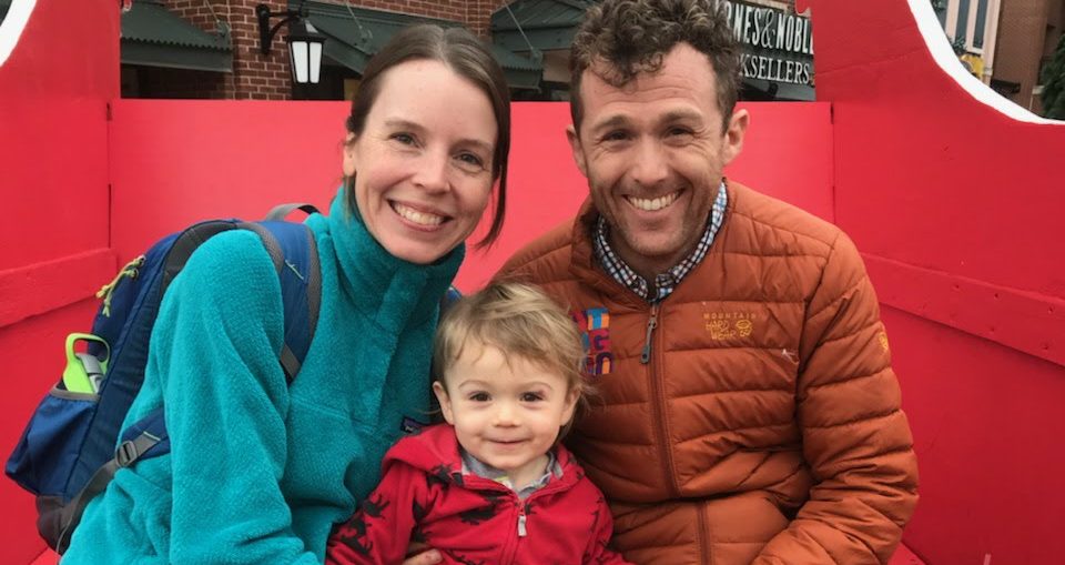
 So, we have kind of a big adventure coming up this summer, the Continental Divide Trail. It’s around 3,100 miles (we’ll get to that in a moment) from Mexico to Canada through the Rockies, passing through the states of New Mexico, Colorado, Wyoming, Idaho and Montana. It’s the last jewel in our Triple Crown of hiking the Appalachian Trail, the Pacific Crest Trail, and the Continental Divide Trail. Out of all three trails, it’s rumored to be the hardest for several different reasons and is often compared to earning a PhD in hiking. In short: it’s long, it’s hard, and it’s not meant for a newbie.
In the last several weeks, I’ve done a lot to prepare for the hike, and I would liken its preparations to that of The Legend Of Zelda. Anyone else remember this video game? I was in grade school when we first purchased the game for our Nintendo system, and our family was hooked on it for several months. The game was a mixture of action, puzzles, adventure, exploration, and questing. There were hidden passages, secret doors, useful tokens…I loved it.
Preparing for the CDT is a little like playing Zelda. Nothing is really set in stone, there’s not even one set path to walk, finding information on it is a like discovering a secret passage, and there are a lot of rumors about it based on others’ opinions. The CDT is shrouded in mystery.
Looking back on both the Appalachian Trail and the Pacific Crest Trail (heck, even the Colorado Trail) reveals just how easy preparation was for those hikes. All we did was purchase a data book for each hike, use that book to plan our resupplies, gather up our gear and food, and poof, we were walking. The CDT is turning out to be a whole different animal, and I’ll explain why, hopefully without making it too boring.
The Route
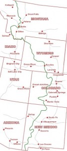 Remember when I said it’s around 3,100 miles? Depending on what route we take, it can be anywhere from 2,500 miles to 3,100 miles, with the average hike being around 2,700. Even as I write this, I’m still shocked there’s not an official mileage. Why? Because the trail is only about 70% done and doesn’t have an entirely defined route.
So how the heck do we find our way? This is where Zelda comes in, or at least Google, where through research on other hikers’ websites and hiking forums, I’ve found that there are several people who offer maps of the CDT “route”. We plan on taking two sets of maps and one set of waypoints loaded onto a GPS. I won’t get any more technical than that, because it could get ugly really fast with how many other maps and waypoints are out there, and let’s not even talk about guidebooks, because we’re actually not carrying any.
As for starting and ending points, we plan on starting at the Crazy Cook Monument on the border of New Mexico and Mexico in late May, and ending in Glacier National Park by early September (actually, ending a few miles into Canada, weather-permitting).
Resupplies
So, how do we plan for a trip that doesn’t have a great guidebook and doesn’t really have mileage? Again, I used my Zelda skills to scour the internet, basically looking at what other hikers have done in the past and looking at what this year’s crop of hikers are doing.
It looks like we’ll go around 3-5 days at a time between towns, and when I say between towns, I mean nothing is between those towns. On the AT, when we planned our resupplies, we skipped hundreds of towns because there were that many more to choose from. On the CDT, whatever towns there are is all we’ve got, and a few of them are as much as 25 miles away from the trail. We will have to hitchhike, a practice we’re ok with but not in love with.
Food
 Matt and I have been vegetarians for over 15 years (him) and 10 years (me), and in the last six months, we’ve been vegan. That means no animal products, including butter, milk, cheese, meat, fish, etc. It’s surprisingly easy to be a vegan while hiking, as there are plenty of products out there without animal products. The real challenge in being a vegan on this trail will be the towns. We’re used to arriving in town and stuffing our faces with a large cheese pizza and a gallon of ice cream. I’m guessing the towns in the middle of nowhere won’t have much kale or quinoa in their restaurants, and definitely no coconut ice cream. We just might have to mail ourselves our own town food in addition to our resupplies in order to load up on calories while in town.
As for food on the trail, we’ve made the decision to not carry a stove. There are usually fire bans on much of the trail in the summer time, and rather than break the law, we’ve chosen to simply go stove-free. We plan on eating granola, energy bars (both sweet and savory), dark chocolate, dehydrated beans, spreads, and soups (all of which only need cold water to rehydrate), and salty snacks like sesame sticks. One thing we learned on the Colorado Trail was that we got the calories and the food types right, just not the variety. We’ll be loading up on a huge variety of these items over the next few months so that we can box them up and have them ready to be sent to the towns along the way up the entire trail.
Gear
 Gathering gear for a trail is a fine balancing act of buying lightweight, trail-appropriate gear that also won’t leave us with a thin wallet. For this hike, we purchased new backpacks from Gossamer Gear that only weigh 16 ounces, a 21 ounce shave off our previous packs, and new sleeping quilts that shaved 14 ounces off our previous sleeping bag weights. We also loaded up on shoes; each of us has 3 pairs of Brooks Cascadia trail runners, and we each bought lightweight wind jackets and hiking pants.
I won’t admit to how much time I spent looking at discount gear websites for deals on gear, or how much time I spent reading trail forums on which gear to purchase. The opinions on gear and weight are all over the place and at the end of the day, we’re using a mixture of new stuff that really shaved weight from our packs, and what we’ve already got, even if it’s a couple ounces heavier than it could be or a year older than it should be. In the end, our packs’ base weights are between 9 and 10 pounds. That’s excluding food and water.
One piece of gear that we recently purchased was an ipad mini. When we hiked the Colorado Trail, we didn’t update the website for the entire 3 week hike, and even that felt like going through website withdrawal. We feel that updating Urbyville will be an important part of the hike, to both chronicle our walk and display the beautiful pictures we hope to capture. We may not even carry a cell phone because we’ll be able to skype through the ipad. How’s that for the amazing acts of technology?
Everything Else
 Grizzly bears, lack of water, logistics, lightning storms…there’s so much more that goes into the planning of this hike, that this really is just a scratch of the surface. Zelda would be oh so disappointed with how little I’ve told you about the secret doors and hidden passageways. But, hopefully you have a better feel for what sort of adventure we’re taking on this summer and what we’ve done to plan for it so far. We’ll put up more updates as the time gets closer, but that’s a quick glimpse into the Continental Divide Trail.
If you’re interested in more nitty gritty details, feel free to email us and we’ll share our secrets. I even have spreadsheets if you really want to see the work I’ve done to plan for this hike.
